You could indeed use both, although I’ve never tried this in practice, in theory in could work.
The 10 fig reference comes up automatically when you tap on somewhere - was used for reference only as a comparison.
OS locate will give you Lat/Long too 
Curveball: you can get an OS map overlay and work out grid references with Dorset Explorer, too. But it’s a mighty fiddly process.
So does Google, the aforementioned (and I’m not saying it’s a suitable tool for our purposes) Dorset Explorer, and many others. You can open a W3W reference in Google Maps and get the lat/long.
Yes. Along with the limitations of a map. Layby? House name? A disused phonebox which is no longer marked on the map?
In the context of HML/ML territory, yes. Maps win. In the context of lowland leader, or scooting in to check a group who’ve evacuated to a layby, W3Ws does have some distinct advantages. “share to Google Maps” being a simple one which removes map faff and route planning.
It’s a tool. It works better at some jobs than others. Please accept this as a fact.
Yep, as I said earlier!
I’m very much in the boat of the more choices the better. W3W better for things near roads, Lat/Long stuff better for the hills!
There is a W3W converter tool for Lat Long also:
But it defeats the point if I have to mess around converting between formats.
Almost every random, free GPS app I have tried has the ability to give location as an OS grid refence.
I see no reason to use W3W other than the fact that the emergency services bought into it unnecessarily.
It’s a gimmick system which has somehow become more popular than the better alternative.
You don’t have to “mess around” with that though, because as discussed the same thing is achieved opening the W3W reference in other apps from inside the W3W app. Couple of taps on the screen.
I already said it has some uses.
But it has some significant drawbacks.
But ultimately back to the issue of needing to get something that translates into a map when you’re on the ground aren’t we?
One last thought from me; if there was a simple way of getting a workable grid reference it would be much more useful.
I’ll leave it at that. Night all.
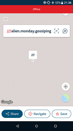
If someone gives me a W3W reference but I don’t have internet connectivity the best I get is:
If my battery dies I don’t even have that.
But if someone gives me a 6,8,10… Figure grid refence I have the option to plug it into my GPS app or traditional GPS unit and get direct navigation or to plot it on a paper map.
It seems like a no-brainer to me.
Well, I for one learnt a lot. I didn’t know you could type a W3W red into Google maps. That’s really useful gen.
If anything, I’m more sold on the app’s utility as part of my location toolkit than I was before this discussion.
Thanks Threaders!
I could make an app for that too  but W3W charge £35 for API access to I’ll pass.
That’s good, ultimately all I care about is keeping our cadets safe, if W3W helps you do that then we’re all winning.
I still feel that What3Emojis is a far superior product.
No ambigious translations, No confusion about single or plural.

Now that I can get behind!
Not seen that before.
Oh and it’s completely open source so no need to pay for an API. Yay!
I don’t follow this. If you open OS Maps from the button in OS Locate, why do you have to type in the GR?
